Africa – climatic zonation
that Africa lies symmetrically to the Equator;
the interdependences between climate, vegetation and soil in each area;
what the climatic factors are
which the climate elements are
how to read data from a climatic diagram;
the elements of natural environment.
how to define location of Africa;
climatic zones’ characteristics;
reasons for the symmetrical setting of climate zones;
to explain the difference between trade winds and anti‑trades;
to describe precipitation in the tropical zone.
Climate zones in Africa
On the surface of Earth there is a spatial order of elements of natural environment, which changes along with the latitude. This phenomenon is known as the geographical zonation. The reason for zonation is the shape of Earth and its location relative to the Sun, which involves the angle of the sun rays, which in return affects changes of the sun energy reaching parallels. Looking at Africa – located symmetrically to the Equator – we can prove the climatic, vegetation and soil zonation, and present interaction between elements of the environment.
Due to the symmetrical location of Africa in relation to the Equator approx. 4/5 of the land is located between the Tropic of Cancer and the Tropic of Capricorn. Flatted surface of the continent and lack of huge mountain ranges allows free atmospheric circulation, typical for the hot zone.
Other important geographical factors influencing climate types in Africa are the highland character of the continent with high edges on the coasts and the system of ocean currents. Two climate elements – air temperature and precipitation volume, and its annual course – are the basis for the distinction of climate types in Africa. In the tropics, the average annual air temperatures fall between 20°C and 30°C. Slightly lower average annual temperatures, from 10°C to 20°C, are recorded only on the northern and southern ends of the continent and in high altitude areas. The sums of annual precipitation also demonstrate a visible zonation. Details were presented on the map below.
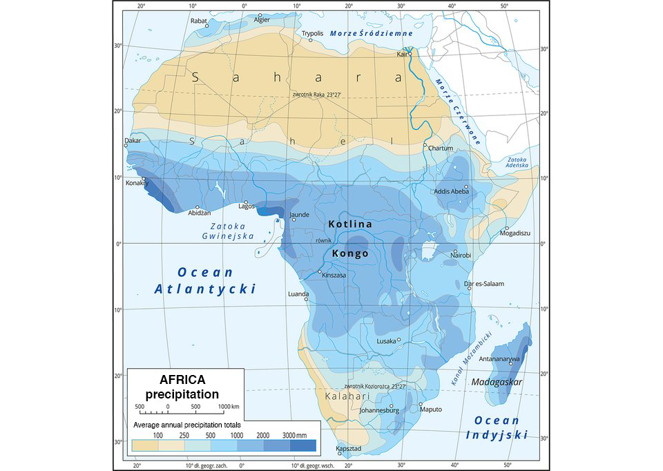
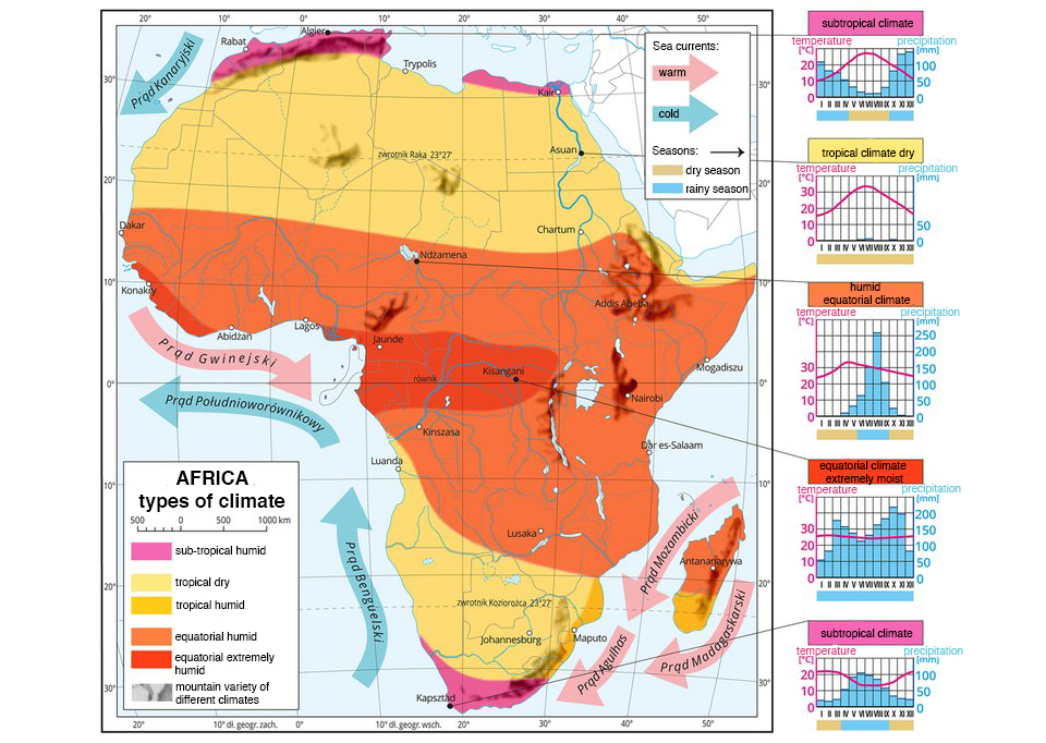
In the equatorial zone, precipitation is high – exceeding 2 thousand mm. The farther north and south, the less rainfall. In Sahara, cut by the Tropic of Cancer, the annual amount of precipitation does not exceed 250 mm. On the contrary, on the Kalahari semi‑desert, which lies on the Tropic of Capricorn, the precipitation is slightly higher and ranges from 250 mm to 500 mm. In the coastal zone aocean currentsaocean currents impact the amount of rainfall. The cold Benguela Current contributed to the creation of the Namib Desert located on the southwest coast. The map of types of climate in Africa and climatic diagrams show their arrangement in zones.
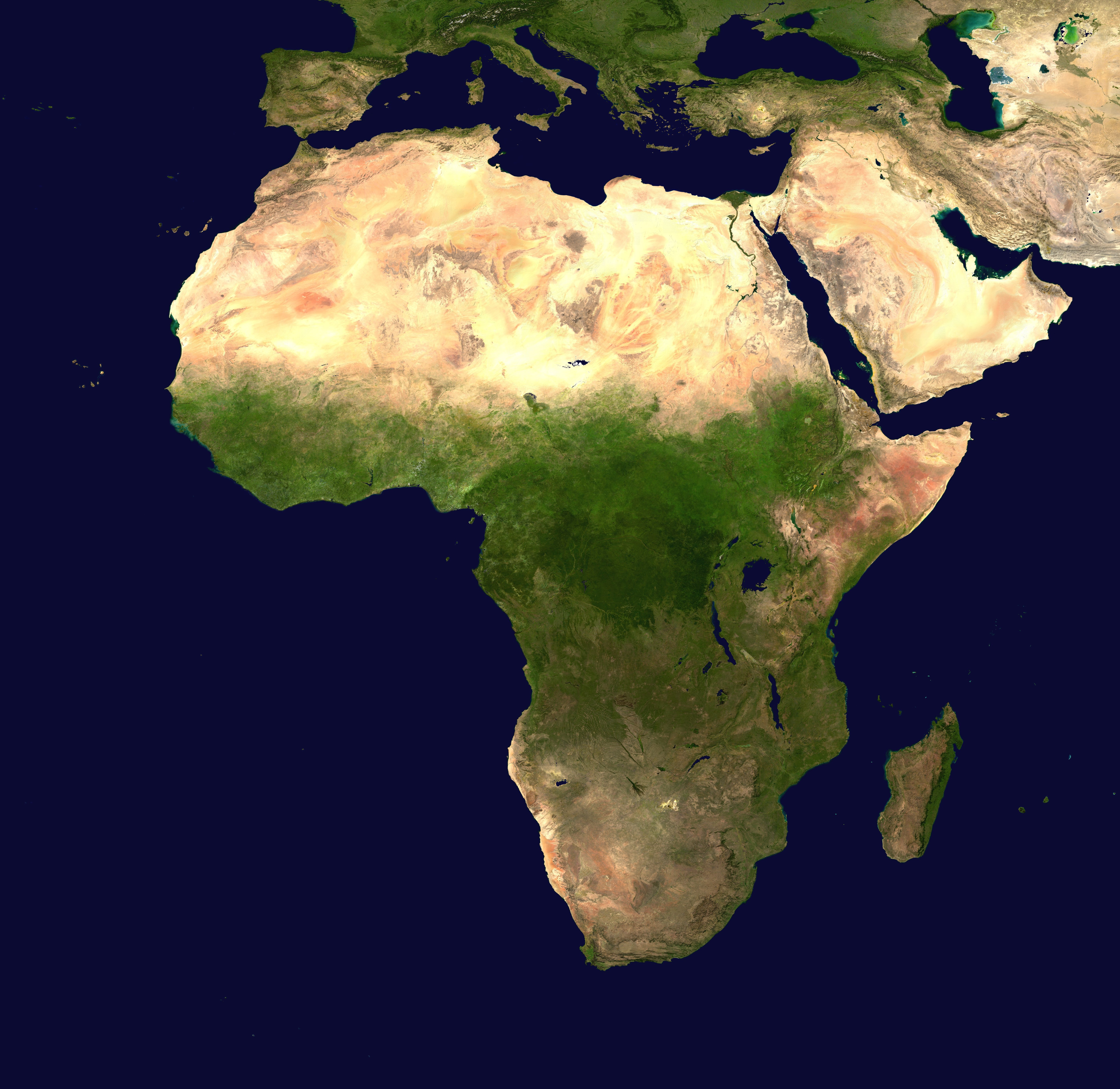
Look at the picture below where the waters that surround the African continent were highlighted.
The geographical location of Africa and the impact of geographical factors mean that:
climate types are arranged symmetrically with the Equator;
hot and warm climate types prevail throughout the entire continent;
distribution of precipitation is conditioned by the atmospheric circulation in the tropic zone and it also has a symmetrical orientation with respect to the Equator;
the course of precipitation in particular months determines the African seasons – rainy and dry.
Each group prepares data regarding selected climate zone in Africa: occurrence, climate features. Write down the conclusions below.
Using the knowledge acquired in class, do the exercises below.
In the map of Africa place the landscape area in the place it belongs to.
Mediterranean vegetation, savannah, Mediterranean vegetation, tropical rainforest, tropical desert
Put words in the text.
Basin of the Congo, equatorial, equatorial forests, savanna, thickets, including, grassy
In Africa are three climatic zones: ...................................., tropical, and subtropical.
In the equatorial climate of the humid .................................... there are evergreen .....................................
In the equatorial climate there is a .................................... formation called .....................................
In conditions of a tropical dry climate deserts were created, .................................... Sahara.
In areas with a subtropical Mediterranean climate, poppy grows. It is formed by evergreen, hardy .....................................
Keywords
savannah, Africa, equatorial forests
Match the pairs: English words with Polish definition.
duże i niemal niezmienne ruchy wody w oceanach wywołane przede wszystkim występowaniem wiatrów stałych oraz różnicami temperatur, bądź zasolenia, a także ruchem obrotowym Ziemi, który modyfikuje ich kierunek., stały, ciepły wiatr wiejący w strefie międzyzwrotnikowej między 35° szerokości północnej i 35° szerokości południowej. Na półkuli północnej pasat wieje z kierunku NE, a na południowej z SE. Wieją one ze strefy wyżów zwrotnikowych ku strefie niżów równikowych.
| ocean currents | |
| trade wind |
Glossary
prądy morskie – duże i niemal niezmienne ruchy wody w oceanach wywołane przede wszystkim występowaniem wiatrów stałych oraz różnicami temperatur, bądź zasolenia, a także ruchem obrotowym Ziemi, który modyfikuje ich kierunek.
pasat – stały, ciepły wiatr wiejący w strefie międzyzwrotnikowej między 35° szerokości północnej i 35° szerokości południowej. Na półkuli północnej pasat wieje z kierunku NE, a na południowej z SE. Wieją one ze strefy wyżów zwrotnikowych ku strefie niżów równikowych.