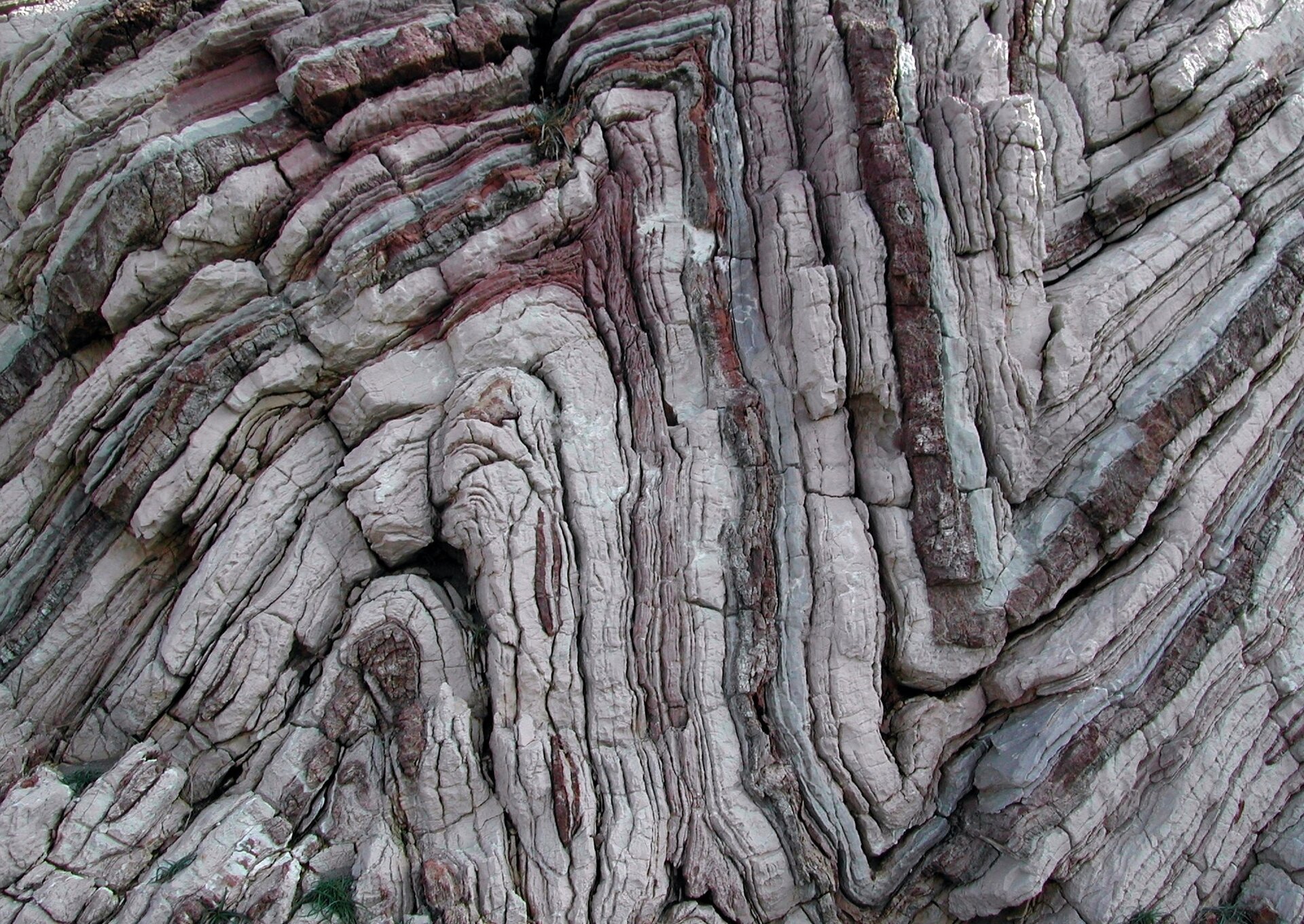
Ilustracja interaktywna
According to the most recent scientific findings, supercontinents form and break up in roughly 500 million years cycles. We are roughly halfway through the current cycle, so in about 250 million years the Earth will look nothing like what we are familiar with nowadays. Study the interactive illustration below to find out more about the processes which cause the formation and breakup of supercontinents on the basis of Pangea.
Według najnowszych badań cykl formowania się i rozpadu superkontynentów zajmuje ok. 500 mln lat. Jesteśmy obecnie w połowie takiego cyklu, co oznacza, że za blisko 250 mln lat powierzchnia Ziemi będzie wyglądała zupełnie inaczej niż teraz. Dzięki poniższej ilustracji interaktywnej dowiesz się więcej na temat procesów rządzących formowaniem i rozpadaniem się superkontynentów – na przykładzie Pangei.
Analyse the interactive illustration, play the recordings and do the exercises below.
Zasób interaktywny dostępny pod adresem https://zpe.gov.pl/a/Dff31pqNp
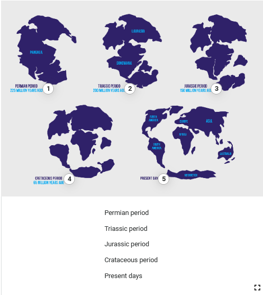
Ilustracja składa się z sześciu map przedstawiających pradawne kontynenty. Ilustracja zawiera pięć punktów interaktywnych, po naciśnięciu których pojawia się nagranie. Transkrypcja nagrań znajduje się poniżej.
Permian period
Grafika nr 1 przedstawia połączone kontynenty. Widoczny jest napis Pangaea.
Triassic period
Grafika nr 2 przedstawia dzielenie się kontynentów. Widoczne są Laurasia i Gondwana.
Jurassic period
Grafika nr 3 przedstawia dzielący się kontynent ziemski. Widoczny jest napis Jurassic Period 150 Million Years Ago.
Crataceous period
Grafika nr 4 przedstawia dzielący się kontynent ziemski. Widoczny jest napis Cretacedus Period 65 Million Years Ago.
Present days
Grafika nr 5 przedstawia obecny stan podziału kontynentów. Widoczny jest napis Present Day.
Put the events connected with the disintegration of Pangea in chronological order starting with the one which happened first.
2. 1. mantle convection forces, 2. erode, 3. Triassic period, 4. submerge, 5. premise, 6. tectonic plates, 7. merge together, 8. glaciation, 9. rifts are the outermost fragments of the Earth's crust.
3. If two or more pieces of something 1. mantle convection forces, 2. erode, 3. Triassic period, 4. submerge, 5. premise, 6. tectonic plates, 7. merge together, 8. glaciation, 9. rifts, they become one entity.
4. 1. mantle convection forces, 2. erode, 3. Triassic period, 4. submerge, 5. premise, 6. tectonic plates, 7. merge together, 8. glaciation, 9. rifts are places where the lithosphere breaks and is being pulled apart.
5. 1. mantle convection forces, 2. erode, 3. Triassic period, 4. submerge, 5. premise, 6. tectonic plates, 7. merge together, 8. glaciation, 9. rifts is a prolonged period of time when the land is covered by thick layers of ice.
6. If rocks 1. mantle convection forces, 2. erode, 3. Triassic period, 4. submerge, 5. premise, 6. tectonic plates, 7. merge together, 8. glaciation, 9. rifts, they gradually wear away as a result of being exposed to natural forces such as wind, water, solar radiation, etc.
Type your answers to each question in 2–3 sentences.
What’s the role of mantle convection forces in the formation and disintegration of continents?
How were the Himalayas formed?
What changes in the positions of continents do scientists predict to happen in the future?