On the river bank
what are the properties of water and in what states of focus it occurs;
what is the circulation of water in nature.
name characteristic sections of the river;
describe the impact of rivers on the environment in particular sections;
understand the mechanisms of formation of bends and oxbow lakes;
explain the direction and speed of water flow in the river.
Nagranie dostępne na portalu epodreczniki.pl
Wysłuchaj nagrania abstraktu i zastanów się, czego jeszcze chciałbyś się dowiedzieć w związku z tematem lekcji.
Greek philosopher Heraclitus of Ephesus commenting on the constantly changing world, once said: “No man ever steps in the same river twice.” He was right – water in a river keeps flowing all the time. Once you are out of a river, the water in it is different a second later. Plus, rivers change all the time.
Rivers in sections
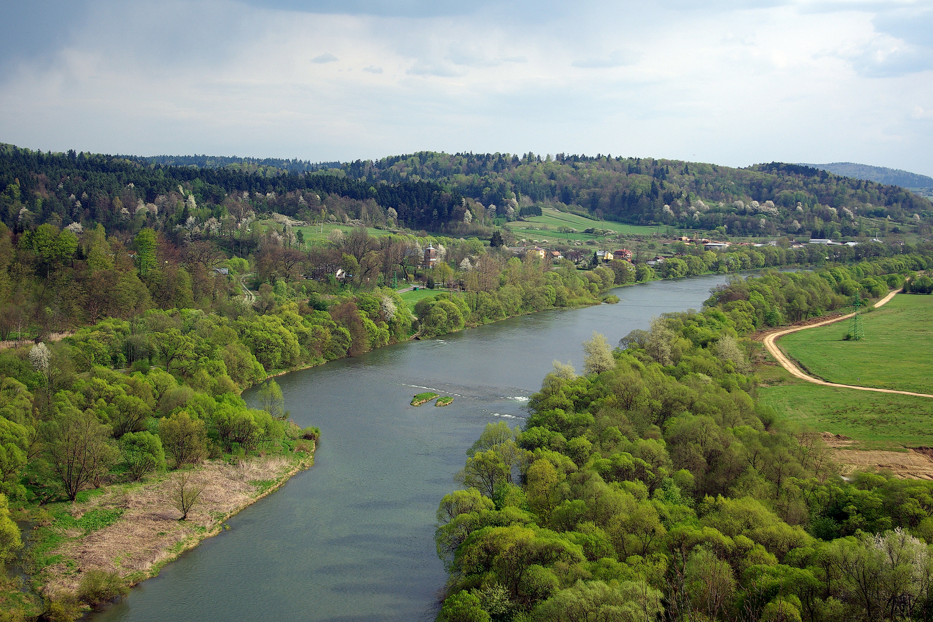
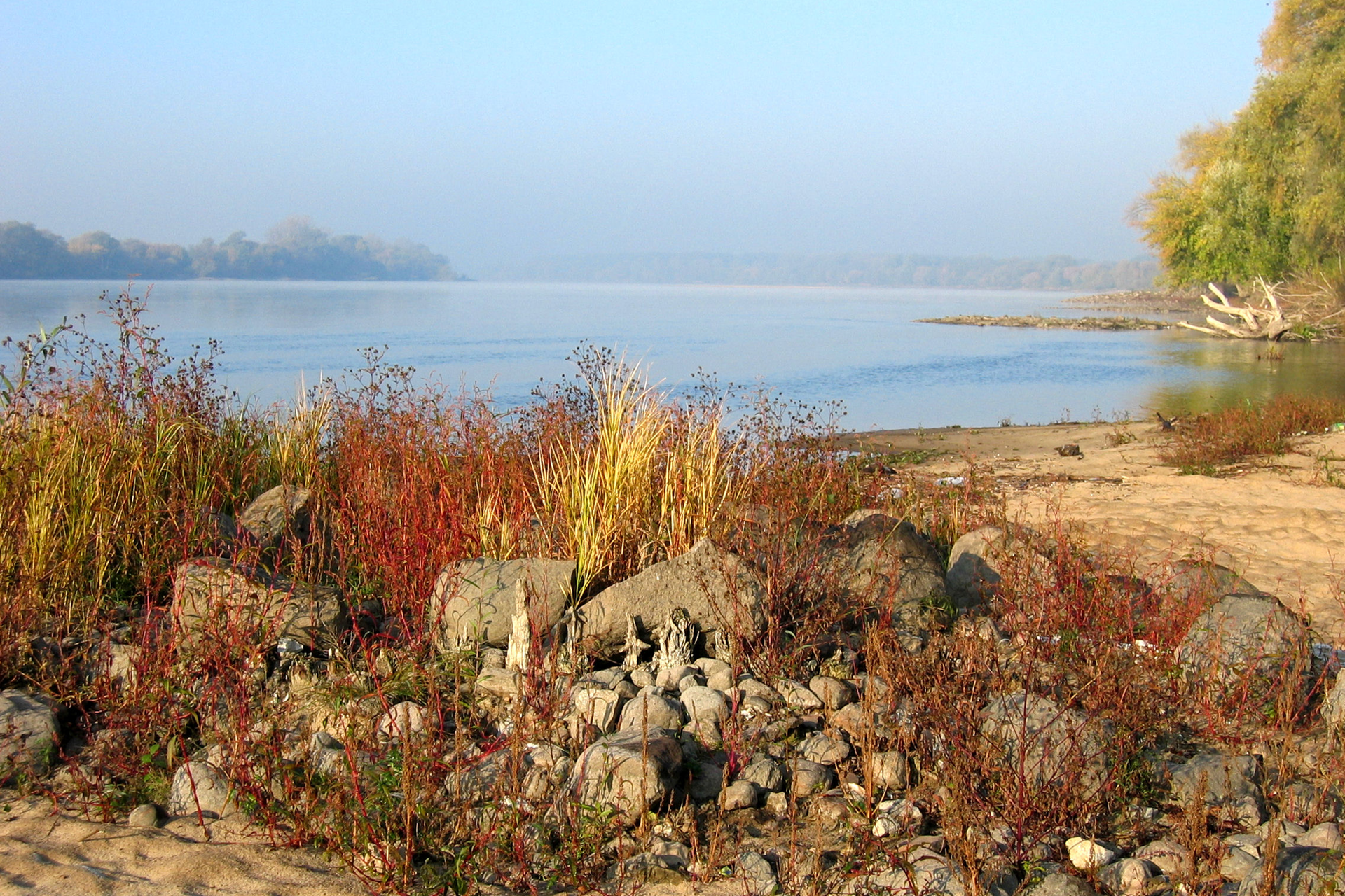
A river in simplest terms is water flowing over the ground in a natural channel. Larger rivers are joined by smaller ones called tributariestributaries. An area occupied by a river and its tributaries is called river basinriver basin. Three sections of a river may be distinguished: upper course, middle course and lower course. Upper course starts at the sourcesource , i.e. the place where the river begins. In Poland most sources are located in mountains and uplands. Due to big height differences (i.e. steep slope) water in the upper course flows fast.The middle course is usually characterised by slower water flow rate than in the upper course. River wears away its banks making its valley wider and taking away small rock particles. If the riverbed is winding, water flows faster by the bank on the outside of each bend. On the inside of bend water speed is lower and that is where water deposits sediments. As a result of this process meandersmeanders are formed; with time meanders may be cut off from the river by sediment and become oxbow lakesoxbow lakes. Lower course is characterised by the slowest water speed. It ends with a mouth,i.e. the place where river joins another river, lake or sea. In the mouth area rivers deposit large quantities of sediments which may lead to a delta being formed. In a delta the riverbed is divided into many branches with wetlands in between.

Watch a film and observe where the water in the rivers comes from and why the water flows where it flows.

Film dostępny na portalu epodreczniki.pl
Film przedstawia eksperyment pokazujący jak formowane są rzeki. Do wykonania eksperymentu potrzebujemy: kartkę, marker, nożyczki, taśmę, spray z wodą. Do kartki przykładamy pięść i owijamy ją kartką. Zgniecioną kartkę rozkładamy na pół płasko (tak żeby została górka) i jej końce przyklejamy taśmą do drugiej kartki. Markerem zaznaczamy krawędzie zgniecionej kartki, następnie psikamy na kartkę sprayem. Woda spływa z góry kartki na dół.
From mouth to source
Each river has a few distinct features:
beginning – usually a source, but some rivers begin, for example, in a lake;
current is the fastest flowing stream of water in the river; in straight sections the current usually runs in the middle of the riverbed, while in bends – closer to the outside bank;
direction of flow of the river is always directed from source to mouth; it may be recognised by observation of the current;
river banks are always determined after finding out the direction of flow; turn your back towards the source and face the mouth of the river to tell the right and left bank.
Learning how to determine and measure water velocity.
measuring tape,
stopwatch or phone with the option of timing,
a dry stick or other floating object with a natural origin, such as a cone (you can not throw plastic or paper into the water!),
sheet and pencil,
possibly a calculator.
In the company of a teacher or other adult, head to the river or a larger stream.
Choose a relatively straight section of the river.
Select the point where the measurement will start. It should be, for example, a bridge or other place from which it will be easy to throw a stick into the water.
Using a tape measure, measure along the edge the distance of 10 m from the place from which the measurement will start. At the end should be a person with a stopwatch prepared for measurement.
Put a stick into the water. At this point, start measuring time. The measurement ends when the stick flows past the other person.
Divide the length of the segment by the measured time. For example, 10 m / 10 s = 1 m/s.
Movement of small leaves, twigs and other objects allows you to determine the speed of flowing water.
Flowing water has enormous power. Therefore, special care should be taken during any work and measurements carried out in the river. Saving the drowning in the river is very difficult even for people who can swim.
Exercises
Match the pairs: English and Polish words.
miejsce, w którym rzeka kończy swój bieg, wpadając do innej rzeki, jeziora lub morza, fragment koryta rzecznego o kształcie przypominającym łuk lub pętlę wykształcony w wyniku erozji bocznej (podmywania brzegu przez rzekę), rzeka, która uchodzi do innej większej rzeki, obszar, z którego wody powierzchniowe spływają do jednej rzeki, naturalny i samoczynny wypływ wód podziemnych na powierzchnię, jezioro leżące w dolinie rzecznej, które jest fragmentem jej dawnego koryta
| tributary | |
| river basin | |
| oxbow lake | |
| estuary | |
| river bend or meander | |
| source |
Fill the blank spaces.
bottom, transported, spring, upland
The upper course of the river begins in the ....................... Rivers in the upper course usually flow in mountainous or ...................... terrain. Due to large differences in altitude, the water flows quickly and with great force destroys the ...................... of the river, carving deeper and deeper valleys. The rocks taken by the water are rolled, crushed and .......................
Summary
Rivers start their course in sources (they can also start it, for example in lakes) and end up in estuaries.
We divide the course of the river into: upper, middle and lower.
In the middle course of the river, the water destroys the banks and, as a result, the bends and then the oxbow lakes are formed.
After heavy rains or spring thaw, rivers can flood and flood.
Keywords
river, estuary, source
Glossary
dopływ – rzeka, która uchodzi do innej większej rzeki.
dorzecze – obszar, z którego wody powierzchniowe spływają do jednej rzeki.
starorzecze – jezioro leżące w dolinie rzecznej, które jest fragmentem jej dawnego koryta.
ujście rzeki – miejsce, w którym rzeka kończy swój bieg, wpadając do innej rzeki, jeziora lub morza.
zakole – fragment koryta rzecznego o kształcie przypominającym łuk lub pętlę wykształcony w wyniku erozji bocznej (podmywania brzegu przez rzekę).
źródło – naturalny i samoczynny wypływ wód podziemnych na powierzchnię.