The natural environment and cultural heritage of Belarus
what the current territorial division of Europe is;
what the Soviet Union (USSR) was;
what democracy is.
to describe the location of Belarus on the map of Europe;
to characterize the natural environment of Belarus;
to discuss the current political situation in Belarus;
to list the main branches of the economy;
Write down your thoughts associated with Belarus.
Location and division of Belarus
Belarus is a medium‑sized country in Eastern Europe. It has an area of more than 207 thousand kmIndeks górny 22, which corresponds to 2/3 of the area of Poland. The capital of the country is Minsk.
Belarus is the largest landlocked European country. It is surrounded on all sides by neighboring countries – Russian Federation in the east, Ukraine in the south, Poland in the west, Lithuania in the northwest, and Latvia in the north. The length of our border with Belarus is 418 km, but its borders with Russia and Ukraine are more than twice as long. The border of Belarus with Poland, Lithuania, and Latvia is simultaneously the external border of the European Union, which is very difficult for Belarusians to cross.
Natural conditions
Belarus is a lowland country situated entirely in the west of the East European Plain. The surface of the land is mostly flat, although there are some variations. In the central part, there are small hills of the Belarusian Ridge with the highest point of the country, the Dzyarzhynskaya Hara, with an altitude of 345 m above sea level. In the north, there is the slightly undulating Belarusian Lake District with the largest lake – Lake Narach – which has an area of 80 kmIndeks górny 22 (slightly larger than our Łebsko Lake).
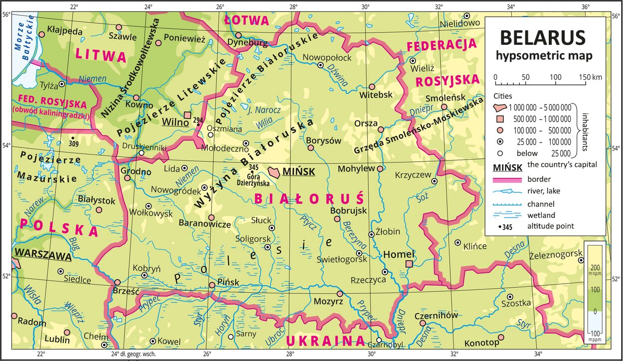
Many large rivers of a typically lowland character flow through the flat terrain of Belarus. Most of them – the Dnieper, Daugava, Neman, Pripyat – are cross‑border rivers. The Belarusian Ridge is the watershed of the catchment areas of the Baltic Sea and the Black Sea. The catchment area of the Baltic Sea includes the river basins of the Daugava, Neman, and Vistula (the Bug, the Narew), while the catchment area of the Black Sea – the river basin of the Dnieper.
The climate in Belarus is temperate, warm, and transitional, but with a predominance of continental effects. Marine effects are clearly limited due to the considerable distance from the sea and the ocean.
The natural vegetation of today’s areas of Belarus used to be mixed forests. Their substrate produced low‑fertility podsolic and lessive soils, and, in some places, slightly better brown soils.
Belarus is a rather densely forested country – forests cover almost 40% of the area. One of the most valuable forest complexes is the Białowieża Primeval Forest, most of which is located on the Belarusian side. Other well‑known forest areas are the Grodno Forest and the Naliboki Forest. There are also many bogs, marshes, and peatbogs. As a result, many wildlife areas have been preserved in the territory of our eastern neighbors.
Population of Belarus
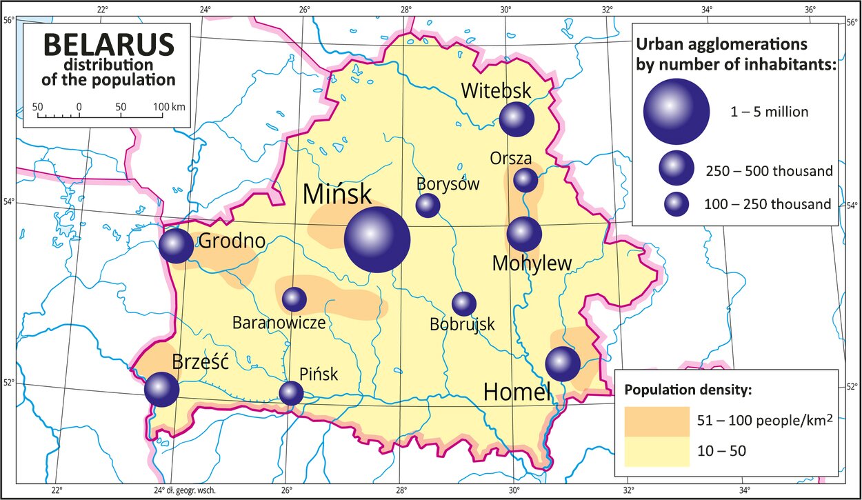
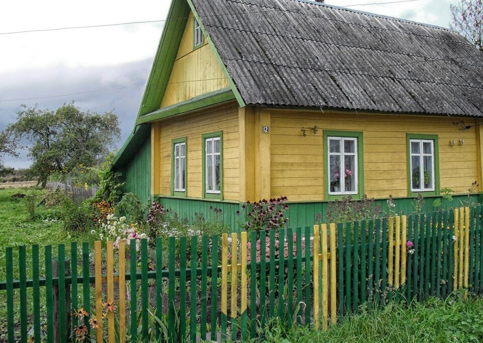
Belarus currently has about 9.5 million inhabitants. This is less than in the Czech Republic, for example, which is more than 2 times smaller. As a result, the population density in Belarus is almost three times lower – only 45 people per 1 kmIndeks górny 22 (in the Czech Republic it is 133 people). The low population density of Belarus is mainly due to significant forestation and relatively large areas occupied by wetlands that are difficult to access. Only about a quarter of the population lives in the countryside. This is also due to the model of Belarusian agriculture, which is based mainly on large state‑owned farms (kolkhozes, sovkhozes), where relatively fewer people are needed to work than on small private farms.
3/4 of the population of Belarus are inhabitants of cities, but there are not many cities. The capital city – Minsk – is home to nearly 2 million people, which is 1/5 of the total population. The remaining cities are much smaller – the largest of them is Gomel, which has fewer than 500 thousand inhabitants, and the next four (Mogilev, Vitebsk, Grodno, and Brest) have about 300 thousand each.
Nearly 80% of the country’s inhabitants are Belarusians. The most numerous national minority are the Russians, who account for about 15% of the population. Interestingly, Russian is still commonly used and remains the second official language alongside Belarusian, which is a proof of the strong social and cultural links between the two countries.
The number of Poles in Belarus is estimated at about 400 thousand, i.e., 4% of the country’s population. They live mainly in border areas, especially Grodno and its vicinity. The Union of Poles in Belarus operates there but, in 2005, there was a split in it. One part of the union remains loyal to the state authorities, and the other openly opposes them, demanding that these authorities respect fundamental rights of the Polish national minority, such as the right to use the Polish language or to travel more freely across our border.
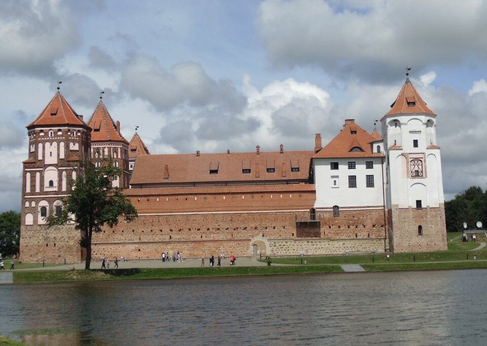
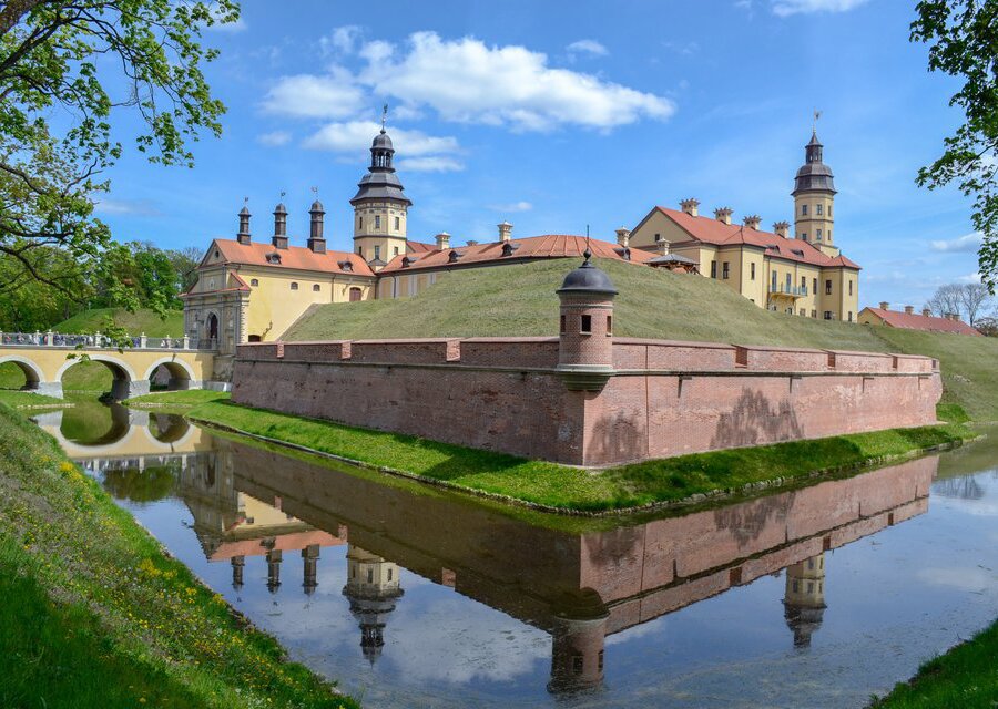
Tourist attractions of Belarus.
Fill the gaps in the sentences.
Black, East European, 40% , Daugava, rivers, podsolic, Neman, Baltic, Dnieper, Polesye, bog, Belarusian, lessive
Belarus is a lowland country that lies in the west of the .......................... Plain.
The main geographic regions of Belarus are the .......................... and the .......................... Ridge and Lake District.
Belarus is covered by a dense network of lowland .........................., the largest of which are the .........................., .........................., .........................., Berezina, and Pripyat.
The Belarusian Ridge is the watershed of the catchment areas of the .......................... Sea and the .......................... Sea.
The natural vegetation of Belarus are mixed forests whose substrate produced .......................... and .......................... soils, locally also brown soils. On wetlands and near lakes there are .......................... soils.
Forests cover almost .......................... of the Belarusian territory.
Arrange the cities of Belarus from the most to the least populated.
- Gomel
- Pinsk
- Grodno
- Minsk
Match the river basins to the corresponding catchment areas.
River basin of the Dnieper, The Neman, The Daugava, The Vistula
| Catchment area of the Black Sea | |
|---|---|
| Catchment area of the Baltic Sea |
Answer the questions.
| The capital of Belarus is... | Minsk |
| Give the name of the country which Belarus borders to the west. | Poland |
| The whole southern part of Belarus is constituted by flat lands, which are sometimes crossed by relatively shallow riverbeds. Give the name of this region. | Polesye |
| The highest point of Belarus is 345 m above sea level. It is located on the... | Belarusian Ridge |
| The population of Belarus is... | 9.5 million |
| The natural vegetation of Belarus are... | Mixed forests |
Keywords
Belarus, Minsk, Polesye
Glossary
obszar zlewni - obszar, z którego wody powierzchniowe i podziemne spływają do jednego morza lub oceanu
wododział - umowna granica oddzielająca sąsiednie dorzecza
dorzecze - obszar, z którego wody spływają do jednej rzeki i jej dopływów