Basic forms of the Earth’s surface marked on maps
that a map is an essential tool for a geographer;
that maps are structured according to specific rules;
that each correct map features a few regular elements;
name large forms of the Earth's surface and the forms of the ocean floor;
define their characteristics;
show them on the map.
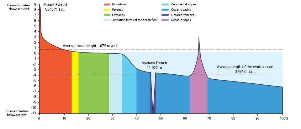
Taking into account absolute and relative altitudes, geographers divided the surface of our planet to variety of landforms (concerning bottoms of the sea and the ocean as well), differing in some aspects. First of all, they distinguished the mountainsmountains, highlandshighlands, lowlands and depressionsdepressions on land, and continental shelfs, continental slopecontinental slope, oceanic basinsoceanic basins and oceanic trenchesoceanic trenches below sea level.
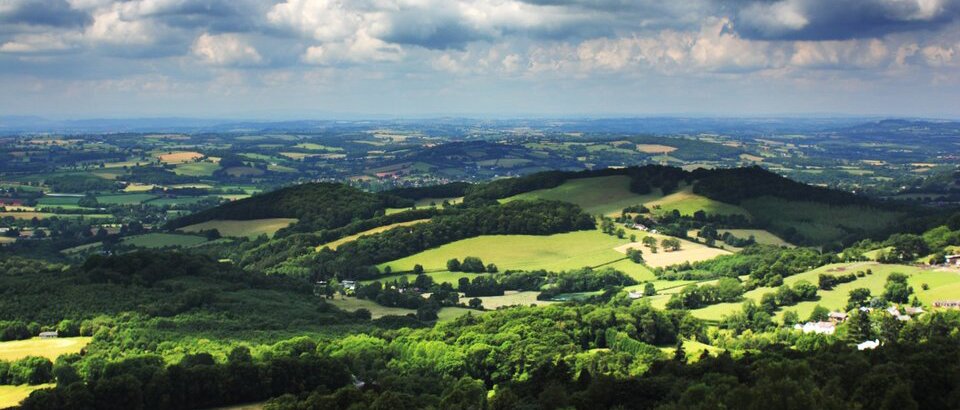
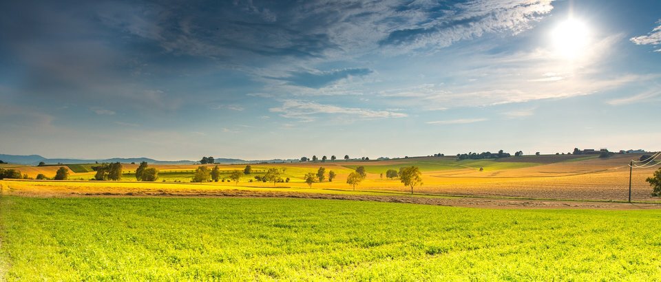
Lowlands are flat or slightly sculpted areas with altitudes not exceeding 300 m above sea level, with occurrences of depressions, i.e. areas lying below sea level. Areas with absolute altitudes exceeding 300 m above sea level and relative altitudes below 300 m are considered highlands. However, in many countries, including Poland, the value separating lowlands from highlands is 200 m above sea level which results from the fact in specific environmental conditions, apart from altitude, geological structure is also taken into account. Elevation of highlands above sea level varies; majority of European highlands lie at 300‑600 m above sea level.
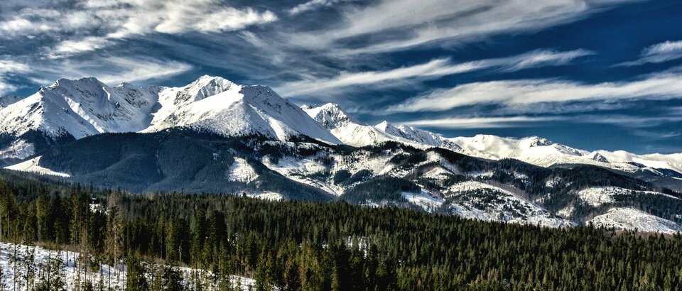
The mountains are landforms with greatly varied sculpture, high inclination of slopes, and relative altitude above 300 m, in relation to adjacent valleys. Due to relative hight and absolute hight the mountains are categorised to low, medium and high.
At the junction of continents and adjacent seas or oceans, a continental shelf is a typical landform, being a flooded part of a continent. This shelf stretches down to 200 m below sea level where it ends abruptly and transforms into continental slope with significant angle of inclination which constitutes a transitional form between continent and deeper ocean.
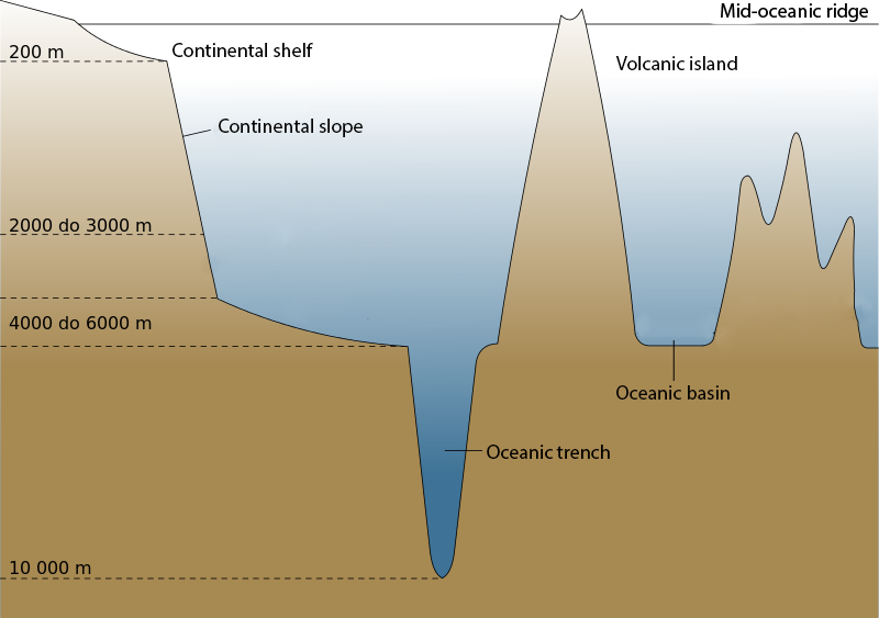
One of the most widespread zones of deep ocean (about 50% of the Earth’s surface) are oceanic basins. Their bottoms lie at the depth of 3000‑6000 m below sea level. Other deep structures in the ocean bottom are oceanic trenches which are elongated depressions with depth reaching more than 6000 m.
Landform percentage in total surface of the Earth is illustrated by a hypsographic curve.
Land morphology may also be shown as a cross section along a selected line. Such diagram is a very good imaging of altitude differences between different landforms located along the relevant line. This type of diagram is called hypsometric profile. The profile is constructed according to a contour line map. The vertical axis shows values of absolute altitudes, and the horizontal axis shows distances according to the scale of the map which constituted a base for construction of such profile.
Match the following landforms with suitable columns - use the geographical atlas.
The Himalayas, Death Valley, East European, The Dead Sea, Coast of the Caspian Sea, East African, West Siberian, The Carpathian, Amazonian, Brazilian, The Alps, Central Siberian, The Andies, La Plata
| Mountains | |
|---|---|
| Uplands | |
| Lowlands | |
| Depressions |
Play a slot machine and answer the questions.
|
Mount Everest
|
The highest mountain of the Earth
|
|
The Mariana Trench
|
A depression
|
|
Raczki Elbląskie
|
10,994 m (36,070 ft)
|
|
Oceanic Basins
|
Their bottoms lie at the depth ranging from 3,000 m (9,842 ft) to 6,000 m (19,685 ft) below sea level
|
Check whether you remember what the words below mean.
| Oceanic basin | A landform in the ocean bottom; oceanic basins lie at the depth of 3000-6000 m below sea level, and cover in total about 50% of the Earth. |
| Oceanic trench | An elongated subsidence of the ocean bottom, located at the depth of more than 6000 m. |
| Mountains | Landform with greatly varied sculpture, high inclination of slopes and relative height above 300 m. |
| Depressions | A land area lying below sea level. |
| Continental shelf | It is a part of a continent, covered with seawater; a shelf extends to 200 m below sea level, at this point transforming to continental slope with an abrupt curve. |
Keywords
Mariana Trench, depression, highlands, uplands
Glossary
basen oceaniczny – forma ukształtowania dna oceanicznego; baseny oceaniczne leżą na głębokości od 3000 m do 6000 m poniżej poziomu morza i zajmują łącznie ok. 50% powierzchni całej Ziemi
depresja – obszar lądowy położony poniżej poziomu morza
góry – formy terenu o silnie urozmaiconej rzeźbie, dużym nachyleniu stoków i wysokościach względnych powyżej 300 m
rów oceaniczny – wydłużone obniżenie dna oceanu o głębokości ponad 6000 m
stok kontynentalny – wąski fragment dna morskiego poniżej szelfu kontynentalnego o stromym nachyleniu; stanowi przejście od szelfu do głębi oceanicznej
wyżyny – to obszary, których wysokości bezwzględne przekraczają 300 m n.p.m., a wysokości względne nie przekraczają 300 m