Changes on the political map of the world
what is a political map;
how the countries of the world are distributed;
that in addition to independent states, there are dependent and disputed territories.
to discuss selected territorial disputes and explain the reasons they have come about;
to use a map of the world to give examples of dependent territories;
to identify new countries that have been created outside of Europe.
The basis for the contemporary political divisions of the world
By the end of the 19th century, the most powerful nations of the world had made a final division of the land (Berlin Congress), hence the geometric borders of Africa.
There were significant border shifts as a result of two World Wars, particularly in Europe. In the 1960's and 1970's independence was declared in many colonies in Africa, Asia, the Caribbean and the Pacific. By the 1980's very few of these remained.
Changes in non‑European areas
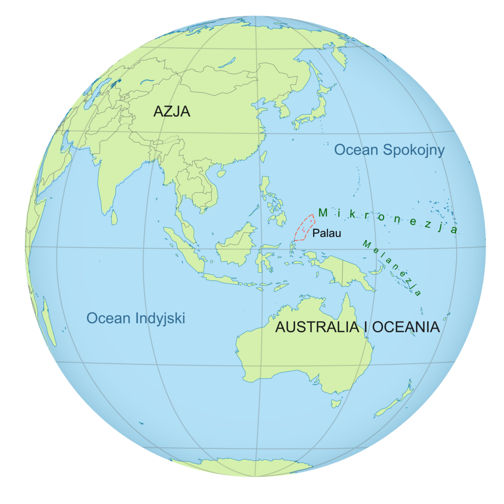
In 1994, in the western Pacific, the Republic of Palau was created – an island nation of 25 000 people. It was the final area administered by the United States as a United Nations Trust Territory.
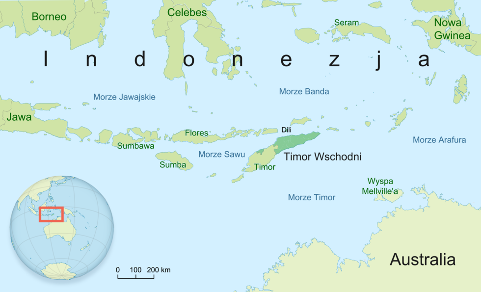
The political history of East Timor is far more dramatic. The eastern part of the island of Timor was colonised by the Portuguese, who imposed their language and religion. After they left in 1975, the entire island was occupied by Indonesia and the battle for Timorese independence began. A referendum was held in 1999, and the country declared its sovereignty three years later.
Use different information sources to complete the exercise below.
Further changes?
The world's political map will never stop changing. Here are some examples of separatist movements in Africa:
Is independence worth it?
In 1974, the majority of people living in the islands of the Comoros Archipelago were in favour of independence. At present, following 40 years of independence, GDP per capita is about 9 times lower than in Mayotte, which remained part of France. French Martinique still has GDP per capita more than double that of its neighbour, the independent St Lucia and Dominica. There are similar disproportions in South American Guyana, Suriname and French Guiana.
Based on the description, specify the city in question: it is a special administrative region of the People's Republic of China, situated in the South China Sea, in the Pearl River Delta. Between 1842 and 1997 it was a British dependency.
- Hong Kong
- Taipei
- Shanghai
- Peking
Pair the independent territory with the relevant state.
United States, Great Britain, Denmark, Australia, France
| Grenland | |
| Bermuda | |
| Coral Sea Islands | |
| Midway Atoll | |
| Guadeloupe |
Keywords
republic, decolonisation, independence
Glossary
ruchy separatystyczne - dążenie do wyodrębnienia się jakiejś grupy z całości. Najbardziej typowym jest separatyzm narodowościowy, a jednym z jego przejawów secesja narodowa.
dekolonizacja - to proces uzyskiwania samodzielności przez terytoria zależne.