that Asia is the largest continent in the world in terms of its area;
that thematic maps enable us to descibe and compare Asia's natural environment.
You will learn
to identify Asia's geographic location;
to pinpoint the extreme points of the Asian continent and identify their geographic co‑ordinates;
to pinpoint the course of the conventional border between Asia and Europe on the map;
to pinpoint to course of the conventional border between Asia and Africa, in addition to North America and Australia on the map. To pinpoint geographical objects included in Asia's horizontal landscape.
Asia is the largest continent on Earth. Its area measures 44.5 million kmIndeks górny 22. The continuous area of land is located entirely in the northern hemisphere and spans from the equator to high circumpolar lattitudes in the North. Many Asian islands are located in the southern hemisphere, including, among others, a large part of the Malay Archipelago. Asia is also almost entirely located in the eastern hemisphere – the only region of Asia that is found in the western hemisphere is the Chukchi Peninsula. Asia and Europe constitute a continuous block of land and the common name Eurasia is often used to refer to them. You already know that the border between these continents is contractual in nature. Europe is often referred to as a great peninsula located to the west of Asia. To the South‑West of Asia, behind the Suez Pass and the Red Sea, is Africa. The Bering Strait, which is 85 km wide, separates Asia from North America. The map shows Asia's geographical location.
R1AGE6GC7zPy7
Mapa hipsometryczna Azji i skrajne przylądki. Mapa pokazuje wody opływające Azję: Ocean Arktyczny, Ocean Spokojny i Ocean Indyjski. Na północy Azji przedstawiono Góry Czerskiego, Wyżynę Środkowo-syberyjską, Nizinę Zachodnio-syberyjską. W centrum kontynentu widzimy Ałtaj i Wyżynę Mongolską, a przesuwając się ku południu Tybet i Półwysep Indyjski. Obok legendy mapy numer: 1, a w nim zawarte pojęcia: zasięg stałej pokrywy lodowej na morzu - the range of the fixed ice cover at sea, zasięg lodu pływającego - range of floating ice, granica państw - state border, szczyt - peak, wulkan - volcano, stolica państwa - capital city, inne miasto - other city.
Mapa hipsometryczna Azji i skrajne przylądki. Mapa pokazuje wody opływające Azję: Ocean Arktyczny, Ocean Spokojny i Ocean Indyjski. Na północy Azji przedstawiono Góry Czerskiego, Wyżynę Środkowo-syberyjską, Nizinę Zachodnio-syberyjską. W centrum kontynentu widzimy Ałtaj i Wyżynę Mongolską, a przesuwając się ku południu Tybet i Półwysep Indyjski. Obok legendy mapy numer: 1, a w nim zawarte pojęcia: zasięg stałej pokrywy lodowej na morzu - the range of the fixed ice cover at sea, zasięg lodu pływającego - range of floating ice, granica państw - state border, szczyt - peak, wulkan - volcano, stolica państwa - capital city, inne miasto - other city.
Source: licencja: CC BY 3.0.
Exercise 1
Wymień trzy najważniejsze według ciebie informacje o kontynencie azjatyckim. Spytaj kolegę lub koleżankę, jakie informacje oni by wybrali.
Wymień trzy najważniejsze według ciebie informacje o kontynencie azjatyckim. Spytaj kolegę lub koleżankę, jakie informacje oni by wybrali.
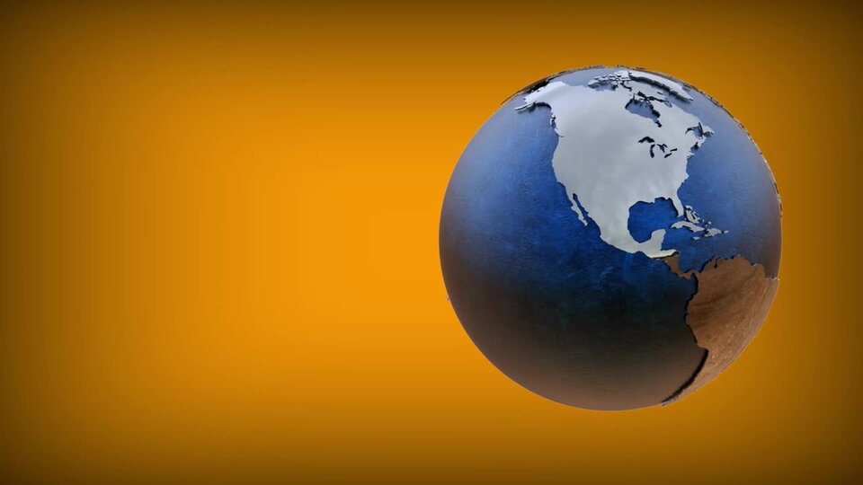
Look at the 3D model of Earth. Write your observations about the Asian continent below.
R1RzuLYwcTPNe
Film przedstawia trójwymiarowy model kuli ziemskiej. Kula ziemska ma kolory: szary- kontynenty, niebieski - morza i oceany. Niektóre strefy kontynentalne mają kolor pomarańczowy np. duży fragment Afryki. Kula ziemska przedstawiona jest na pomarańczowym tle.
Film przedstawia trójwymiarowy model kuli ziemskiej. Kula ziemska ma kolory: szary- kontynenty, niebieski - morza i oceany. Niektóre strefy kontynentalne mają kolor pomarańczowy np. duży fragment Afryki. Kula ziemska przedstawiona jest na pomarańczowym tle.
Film przedstawia trójwymiarowy model kuli ziemskiej. Kula ziemska ma kolory: szary- kontynenty, niebieski - morza i oceany. Niektóre strefy kontynentalne mają kolor pomarańczowy np. duży fragment Afryki. Kula ziemska przedstawiona jest na pomarańczowym tle.
RTVLDELlkzPRK
Wykonaj zadanie zgodnie z poleceniem.
Wykonaj zadanie zgodnie z poleceniem.
RthnTrqKt0e6J
Exercise 2
Wymień kilka nazw azjatyckich wysp.
Wymień kilka nazw azjatyckich wysp.
Source: licencja: CC 0.
R13zhtHokp99d
Exercise 3
Wzdłuż jakiej cieśniny biegnie granica między Azją a Ameryką Północną?
Wzdłuż jakiej cieśniny biegnie granica między Azją a Ameryką Północną?
Match the pairs.
Bering, The Gulf of Aden, Cape Chelyuskin, Timor and Arafura, The Bay of Bengal, The Arabian Peninsula
The border between Asia and North America runs along this strait
The most extreme point in the North of Asia is…
The largest peninsula in Asia is…
What is the name of the body of water between the Indian Peninsula and the Indochinese Peninsula?
The border between Asia and Australia runs through these seas:
What is the name of the bay that the border between Asia and Africa runs through?
Rxlnbc8MEqHtR
Exercise 4
Fill in the text with the correct words.
Asia is the - tu uzupełnij - continent on Earth. Its area measures - tu uzupełnij - million square km. The continous land area is located entirely in the - tu uzupełnij - hemisphere and spans from the equator to high, circumpolar latitudes. Asia is also almost entirely located in the - tu uzupełnij - hemisphere – the only region of Asia that is found in the western hemisphere is the - tu uzupełnij - In the South-west of Asia, behind the Suez Pass and the Red Sea, is - tu uzupełnij -. The Bering Strait, which is - tu uzupełnij - wide, separates Asia from North America.
słowa do uzupełnienia: 1. largest, 2. 44.5, 3. eastern, 4. Chukchi Peninsula, 5. Africa, 6. 85 km
Fill in the text with the correct words.
eastern, Chukchi Peninsula, 85 km, Arabian Peninsula, largest, Australia, 8 km, 44.5, northern, smallest, South, West, Africa
Asia is the .................................. continent on Earth. Its area measures .................................. million km2. The continous land area is located entirely in the .................................. hemisphere and spans from the equator to high, circumpolar latitudes. Asia is also almost entirely located in the .................................. hemisphere – the only region of Asia that is found in the western hemisphere is the ..................................
In the South-west of Asia, behind the Suez Pass and the Red Sea, is ................................... The Bering Strait, which is .................................. wide, separates Asia from North America.
poziome ukształtowanie powierzchni – kształt powierzchni Ziemi wyznaczony przez linię brzegową. Formami ukształtowania poziomego są m.in. wyspy i półwyspy (na lądzie) oraz zatoki i cieśniny (na morzu).