Distances on the map
what a map is and what it is used for;
how to orientate the map in relation to area points;
how to use a compass;
what the basic directions of the world are.
measure the distance between cities using the map scalemap scale;
explain the concept of scale;
how to correctly interpret the linear scale.
What is the scale?
In order for plans and maps to work well, they must inform us about the distances between different places. That's why when creating plans, mapsmaps and sketches we use a scale. It is placed in the map legend and informs us how many times the actual size of an object or area has been reduced or enlarged compared to the same objects in the field. The scale can be shown as a linear scalelinear scale. It is a representation of the scale on the drawing, thanks to which you can make a quick measurement on the map.
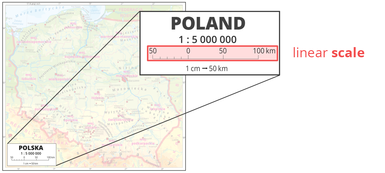
If we say that one map is made on a smaller scale than another map to which we compare it, it means that the distances on the second map are more reduced. Let's also remember that the larger the scale, the smaller distances can be shown on the plan.
How to measure distance in a straight line?
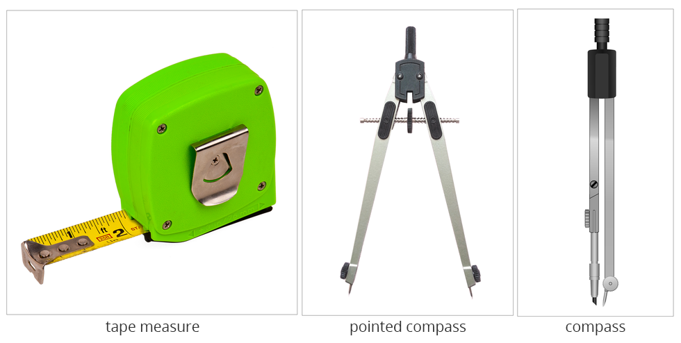
The exact measurement of the distance in the field can be easily obtained using any map that has a linear scale. You will need a bow‑compass or a scribe‑compass to do the calculations. The bow compass is better because it is more accurate, and every fraction of a millimeter can affect the amount of error. How to make such measurements, read the exercises below.
Before you watch the movie „Measure a straight line on the map”, write the research question and the hypothesis. Make notes while watching the movie, and finally add conclusions.
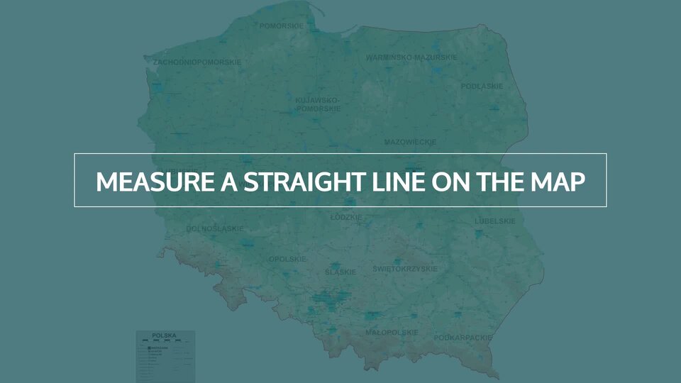
Film dostępny na portalu epodreczniki.pl
Nagranie filmowe. Pomiar odległości mierzonej w linii prostej między miastami na mapie. Potrzebna mapa, cyrkiel, linijka, kartka. Mierzona jest odległość między Krotoszynem a Ostrowem Wielkopolskim najpierw rozstawionym cyrklem na mapie, potem na podziałce liniowej. Rozstawienie cyrkla to samo na mapie i na podziałce.
Measurement of the distance measured in a straight line between cities on the map.
map of Poland,
bow‑compass or scribe‑compass,
ruler,
card.
Set one point of the compass at the beginning of the distance.
Spacing the arms of the compass so that the second spike is at the end of the measured section.
Place the compass next to the scale of the linear map. Be careful not to move its arms. One compass spike should be set to zero and the other point should be set to the end of the measurement. Read distance measurement to show the area distance.
If the measured distance is longer than the linear scale of the map, use the compass to measure the distance represented by the linear scale. Do it the same way as in points 1 and 2.
Measure and count how many times the linear scale will fit the length of the measured route. If the remaining end is smaller than the linear scale, measure it separately as in points 1 – 3. Sum up results – you'll get the distance in the field.
Measure the distance on the map with a ruler. Measure the route on the map with a ruler. Next, apply the ruler to the linear scale or, if the measured section is long, draw a line of the same length on the sheet. Then measure the length of the linear scale from the map with compass. Proceed in the same way as in steps 1‑3.
Wanting to calculate the distance in the field based on the map:
- you must measure these distances "by eye".
- you must ensure that it is a straight line, otherwise you will not measure.
- you must know its scale.
- all you have to do is know the characters.
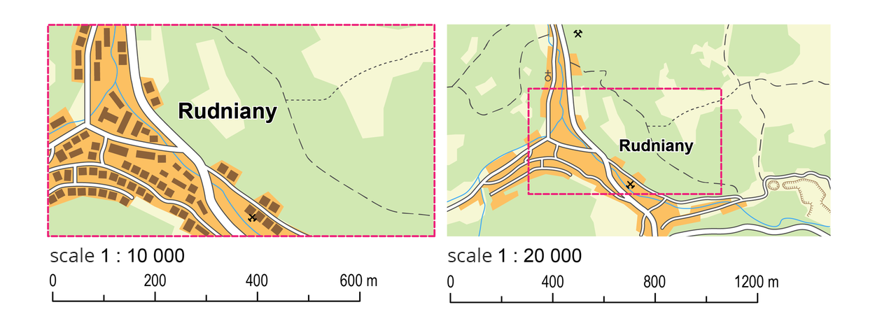
Organize maps by scale, starting from the one made on the smallest scale.
- 1: 75 000
- 1: 500 000
- 1: 10 000
- 1: 20 000
Summary
The degree of reduction or enlargement of objects or distances on a plan or map in relation to the appropriate size or distance in the field is defined by means of a scale.
The scale of the map or plan can be presented as numerical, nominated or in the form of a linear scale.
Thanks to the scale, you can calculate the real distance between different places.
Keywords
Scale, linear scale, map
Glossary
podziałka liniowa – graficzny obraz skali, służący do szybkiego pomiaru odległości na mapach; podziałka liniowa przedstawiana jest jako odcinek podzielony na równe części, które reprezentują odległość na mapie odpowiadającą odległości w terenie
mapa – uproszczony obraz powierzchni Ziemi, innej planety lub ich części przedstawiony na płaszczyźnie w odpowiednio dobranej skali za pomocą umownych znaków i zgodnie z określonym odwzorowaniem kartograficznym
skala mapy – stosunek wielkości liniowych rozmiarów fragmentu powierzchni, dla jakiego opracowano odwzorowanie kartograficzne danej mapy, do rzeczywistej wielkości tych rozmiarów