The lay of the land in Asia
that Asia is the largest continent in the world in terms of surface area;
that thematic maps allow to describe and compare the natural environment in Asia.
to discuss the relationship between the lay of the land in Asia and the geological structure;
to analyze the hypsometric profile of Asia;
to show, on a map, the largest landforms of Asia.
Warm‑up task. Using the available materials, write down a definition for each word.
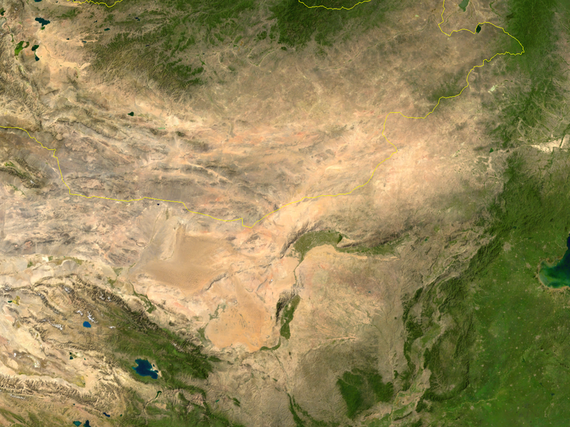
Asia is dominated by upland and mountain areas. They cover 3/4 of the continent. Asia is the highest of the inhabited continents. The average land height is 990 m above sea level.
The highest mountain range on Earth – the Himalayas; the highest point – Mount Everest which is 8850 m above sea level. Other names of this peak are Chomolungma, and Sagarmatha.
The deepest depression can be found in the Dead Sea depression and reaches about 403 m below sea level (depending on the level of water).
In the central part of Asia, there is a great, vast, upland area formed by the Tibetan Plateau – the highest upland in the world (4–6 thousand meters above sea level), and the Mongolian Plateau which turns into the Central Siberian Plateau in the north.
Extensive lowland areas: The West Siberian Plain and the Turan Depression in Central Asia. The lowlands formed by rivers are of great significance. These include: The Mesopotamian Lowland, the Indus Lowland, the Ganges Lowland, and the North China Plain.
Belts of young, fold mountains arranged latitudinally, surrounding the upland areas in south‑western and central Asia. Only this continent has peaks that exceed 8 thousand meters above sea level, 10 of which are located in the Himalayas, and 4 – in the Karakoram.
A large number of old mountain ranges lying in the north‑eastern part of Asia, e.g., the Sayan Mountains, the Chersky Range, and the Altai Mountains.
The lay of the land in Asia is characterized by great variation in height and in the extensiveness of the landforms.

depression
sea level, 3. coverage of the fixed ice plate at sea
the range of floating ice
border
peak
volcano
capitop
other city
What is the geographic object?
| Mongolian | Upland |
| Tarim | Basin |
| West Siberian | Plain |
| Tibet | Upland |
| Chinese | Plain |
| Kamchatka | Peninsula |
| Deccan | Upland |
| Tien Shan | Mountains |
| Ural | Mountains |
| Manchurian | Plain |
| Turanian | Plain |
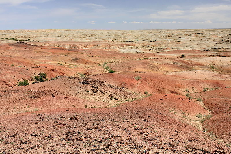
Which photos does not present the Gobi Desert?
- A
- B
- C
- D
- E

Move the geographical objects to the appropriate groups.
Taymyr, Turan, Malay, Himalayan, Ganges, Pamir, Hokkaido, Korean, Sakhalin, Taiwan, Altai, Arabian, Kamchatka, Indochinese, West Siberian, North China, Sumatra, Indus, Tian Shan, Sulawesi, Mongolian, Kunlun, Chersky, Ceylon, Central Siberian, Sayan, Indian, Iranian
| Mountains | |
|---|---|
| Plateaus (uplands) | |
| Plains (lowlands) | |
| Peninsulas | |
| Islands |
Keywords
Asia, depression, landforms of Asia
Glossary
kryptodepresja - dno zbiornika wodnego w obszarze lądowym niebędącym depresją znajduje się poniżej średniego poziomu oceanu światowego.
Nagranie dostępne na portalu epodreczniki.pl
Nagranie słówka: Lay of the land (in the vertical dimension)
Układ gruntu (w wymiarze pionowym) - zróżnicowanie wysokościowe powierzchni Ziemi.
Nagranie dostępne na portalu epodreczniki.pl
Nagranie słówka: Lay of the land (in the horizontal dimension)
Układ gruntu (w wymiarze poziomym) - kształt powierzchni Ziemi wyznaczony przez linię brzegową. Formami ukształtowania poziomego są m. in. wyspy i półwyspy (na lądzie) oraz zatoki i cieśniny (na morzu).