Modern map creation technologies and how to interpret them
how traditional maps were created and what they are composed of;
how to read and interpret the contents of maps;
how to read the geographical co‑ordinates, distance and height above sea level of a given object found on a map.
what modern navigational systems are used for;
to interpret modern maps and aerial photographs;
to explain the importance of GIS in contemporary geography.
Before beginning the lesson, put together the puzzle showing an aerial photograph.
Put the puzzle together.
Long ago, cartographers only put what they themselves could see on their maps. In later times, they were aided by measuring instruments and photography. Shortly afterwards, mapping was made much easier by aerial photographs. Today, photographs taken in space show the entire surface of the Earth with great accuracy, and each one of us can make use of satellite navigation.
Why take aerial and satellite photographs?
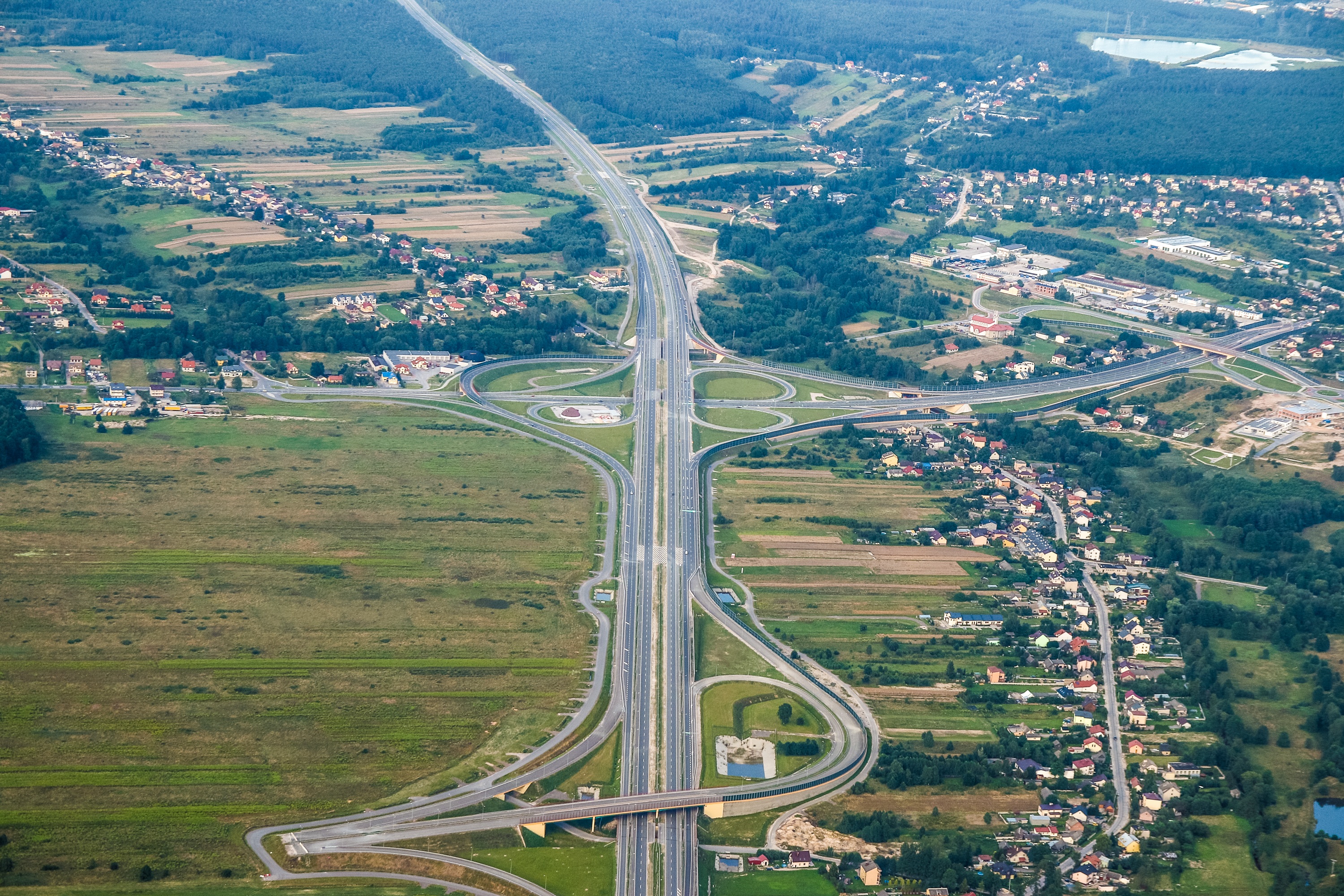
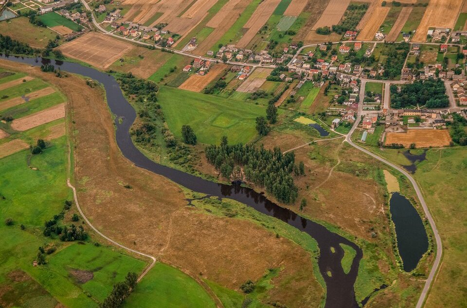
Aerial photographsAerial photographs are pictures of the Earth's surface taken from balloons, planes, helicopters, gliders, hang gliders, kites and dronesdrones. On the basis of these professional aerial photographs and measurements carried out by surveyors, cartographers develop topographic maps.
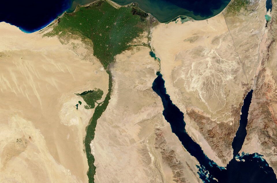
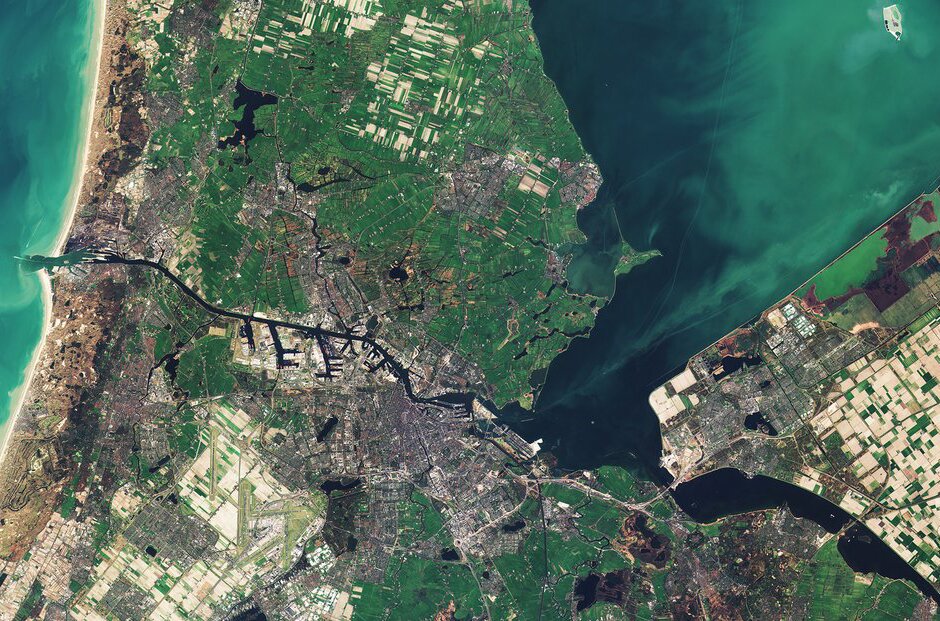
The history of satellite imagessatellite images is much shorter than the history of aerial photographs. In 1946, the first image of the Earth's surface in history was taken from space. A camera fitted on a V‑2 rocket photographed the New Mexico desert. In 1960, the American meteorological satellite TIROS‑1 was launched into Earth's orbit, where it took the first blurry satellite image of a small part of the Earth. Twelve years later, in 1972, the first artificial satellite specially designed to survey the Earth was put into action. It was named Landsat 1. The most recent in this series – Landsat 8, has been functioning since February 2013. The devices mounted on these satellites have taken millions of pictures, which have been used in cartography, agriculture, geology, forestry, administration, transport, education and the millitary, as well as in many other fields. Currently, dozens of scientific, commercial, meteorological, military and spy satellites are taking satellite images of every corner of the Earth with ever higher resolution.
To understand where we draw our exact knowledge of cartography from, watch the film available on e‑podreczniki.pl.
After processing the acquired satellite images or aerial photographs, an orthophotomaporthophotomap is created, that is, a photographic map combined with a co‑ordinate system in the appropriate cartographic projection. It is characterised by a lack of terrain distortion and a uniform scale for the whole region represented in the image.
Satellite navigation systems – how do they work and what are they used for?
There are currently several satellite navigation systems in operation. The oldest and most popular among them is the Global Positioning System (GPS), whose range covers the whole globe. GPS' task is to provide users with information about their location. The system relies on the work of 31 satellites orbiting the Earth, of which at least 28 are constantly active, and at least 4 are always visible from anywhere on the planet. These satellites orbit at a height of 20 183 km. GPS works by measuring the time it takes for a radio signal to reach the receivers of the four closest satellites. The GPS system was created, and is maintained and managed by the US Department of Defense. It is publicly available and free.
The Russians created an alternative navigation system to GPS called GLONASS. It transmits two types of signal: military and civillian. The system comprises of 24 satellites and a terrestrial control station.
The European Space Agency (ESA) is currently working on the navigation system Galileo, which will comprise of 30 satellites.
Watch the film in the internet which shows how GPS works.
GIS – geographical information systems
Geographical Information Systems (GIS) are information systems which allow interactive, multi‑level, highly detailed images of the Earth's surface, and data linked to it, to be shown. When creating these systems, advanced information technologies were used.
With their help, a variety of spacial data is being collected, processed and imaged (visualised). These systems, among others, make it easier for local and state administration, in addition to other types of services (for example firefighters, the police, forest services, meteorological services, etc), to make important decisions. Besides this, they are used in many branches of the economy and in the work of scientists.
One example of such a system is the Wrocław Spacial Information System, thanks to which very useful maps have been created on the basis of data collected.
Based on the knowledge you have gained during the lesson, complete the exercises below.
Read the description and say what it is about.
| It is available everywhere; a geographic location system and a database for navigation. | GPS |
| Geographic information systems. Modern tools, based on the latest technology. | GIS |
| It is created after images obtained from satellites or aerial photography have been processed. It is a photographic map combined with a co-ordinate system in an appropriate cartographic projection. It is characterised by a lack of terrain distortion and a uniform scale for the whole of the region represented in the image. | Orthophotomap |
| An airship, which is unable to take a crew or passengers onboard; it is piloted remotely or carries out a flight automatically; small and cheap versions are being used more an more often to photograph the Earth's surface. | Drone |
| Photography of the Earth's surface carried out from great heights using aircraft (balloons, planes, gliders, kites and drones). | Aerial photographs |
Match the pairs: English words with Polish definition.
mapa, której treść przedstawiono za pomocą zdjęć satelitarnych; powiązana jest z układem współrzędnych w odpowiednim odwzorowaniu kartograficznym; charakteryzuje się brakiem zniekształceń terenu i jednakową skalą dla całego obszaru przedstawionego na obrazie, fotografie powierzchni Ziemi wykonywane z dużych wysokości przy wykorzystaniu statków powietrznych (balonów, samolotów, szybowców, latawców, dronów), statek powietrzny, który nie ma możliwości zabrania na pokład załogi ani pasażerów; jest pilotowany zdalnie lub wykonuje lot autonomicznie; małe, tanie wersje dronów coraz chętniej wykorzystuje się do fotografowania powierzchni Ziemi, fotografie powierzchni Ziemi wykonywane z pokładu statków kosmicznych lub przez sztuczne satelity
| drone | |
| orthophotomap | |
| aerial photograph | |
| satellite image |
Using the website http://mapy.geoportal.gov.pl compare the Tricity region shown on the topographic maps displayed there, on a general geographic map and in satellite images and aerial photographs which have been transformed into an orthophotomap. State the most important differences between these representations of the Tricity area.
Keywords
the Globe, centrifugal force, the shape of the Earth
Glossary
dron – statek powietrzny, który nie ma możliwości zabrania na pokład załogi ani pasażerów; jest pilotowany zdalnie lub wykonuje lot autonomicznie; małe, tanie wersje dronów coraz chętniej wykorzystuje się do fotografowania powierzchni Ziemi
ortofotomapa – mapa, której treść przedstawiono za pomocą zdjęć satelitarnych; powiązana jest z układem współrzędnych w odpowiednim odwzorowaniu kartograficznym; charakteryzuje się brakiem zniekształceń terenu i jednakową skalą dla całego obszaru przedstawionego na obrazie
zdjęcie lotnicze – fotografie powierzchni Ziemi wykonywane z dużych wysokości przy wykorzystaniu statków powietrznych (balonów, samolotów, szybowców, latawców, dronówdronów)
zdjęcie satelitarne – fotografie powierzchni Ziemi wykonywane z pokładu statków kosmicznych lub przez sztuczne satelity